

New Guinea
New Guinea, with a land area of approximately 876 800 km2, is located immediately south of the Equator in the southwestern Pacific, just north-east of Australia. It is separated from northern Australia by Torres Strait, the Arafura Sea and Coral Sea. The mainland of New Guinea and its associated archipelagos stretch across a distance of almost 3,000 kilometres between the equator and 12° south on the southeastern rim of the Pacific Ocean. Geologically, the island of New Guinea is a northern extension of the Australian tectonic plate, forming part of a single landmass called Sahul. Consequently, many species of fauna found in New Guinea have close genetic links with corresponding species found in Australia. One notable feature in common for the two landmasses is the existence of several species of rainbowfishes, which are not found elsewhere.
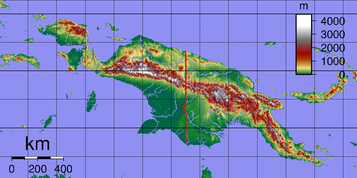
The term New Guinea refers to the entire island, consisting of both the Indonesian province of (West) Papua and the independent nation of Papua New Guinea (PNG). The political boundary follows the 141st meridian east of Greenwich (141° E). The border does not actually run through 141°E all the way. From the northern coast near Wutung, the border follows 141°E until it reaches the Fly River, and then follows the river southward until it reaches 141°01’E, and then along 141°01’E until it reaches the southern coast near the mouth of Bensbach River. To the north, a small section of the Sepik River also lies to the west of 141°E between 4° S and 5°S. Nevertheless, no such compromise has been made to the borderline at the two points where the Sepik River crosses 141°E.
The country's geography is diverse and, in places, extremely rugged. A spine of mountains, the New Guinea Highlands, runs almost the entire length of the island. The New Guinea highlands are a chain of mountain ranges and inter-mountain river valleys that extends over 1600 kilometres from the Vogelkop Peninsula to the Owen Stanley Ranges in the southeast. These highlands are a complex system of ranges, upland valleys and volcanoes, which form the backbone of the island and divide the island into a northern and a southern zone, as the mountains run east-west, parallel to the long axis of the island itself. The mountain range varies in width from some 50 kilometres to around 200 kilometres.
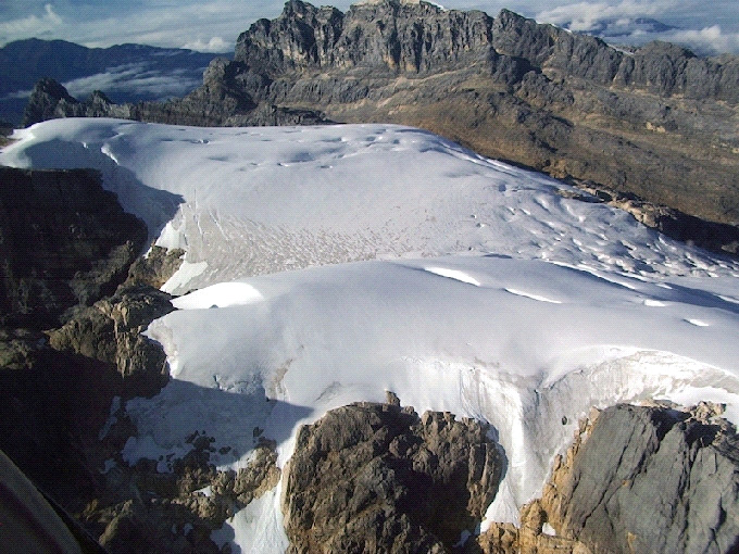
Notable ranges include the Owen Stanley Range in the southeast, whose highest peak is Mount Victoria at 4,038 metres; the Albert Victor Mountains; the Sir Arthur Gordon Range; the Bismarck Range, whose highest peak is Mount Wilhelm at 4,509 metres, which is an extinct volcano with a crater lake; the Star Mountains and the Maoke Mountains or Snow Range in the west, where perpetual snow is found, and whose highest peaks are Puncak Jaya (Mount Carstensz) at 5,030 metres and Puncak Trikora (Mount Wilhelmina) at 4,750 metres. These highland regions are cooler and less humid but generally equally wet. Temperatures vary along an altitudinal gradient, the hot (25~30°C) wet tropical climate of the coastal plains giving way to much cooler (12°C @ 3000 metres) conditions in the highlands.
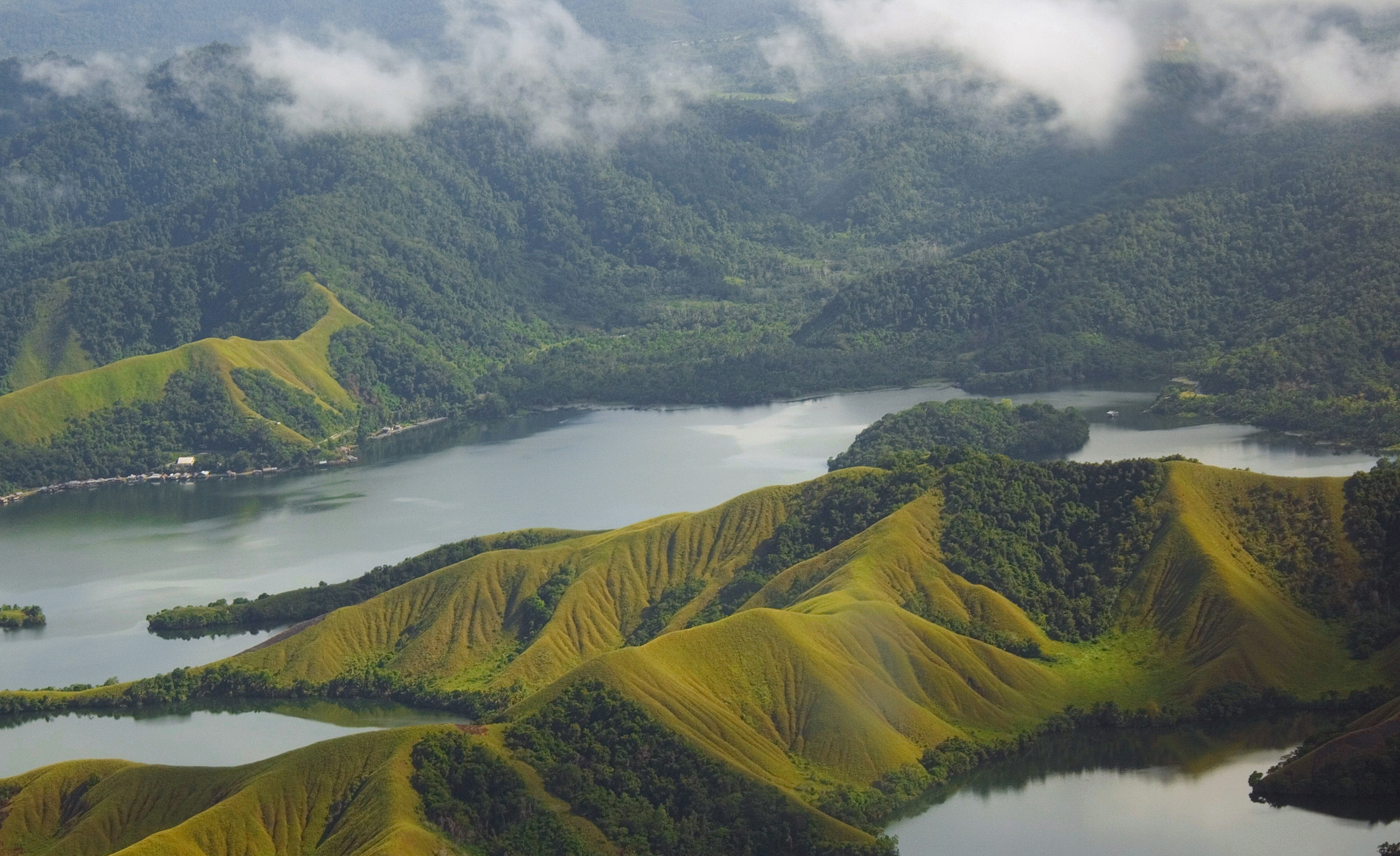
Habitats range from the coastal hot, wet and swampy plains of the south to the permanently snow and ice covered mountains. It has a significant portion of the world’s remaining tropical forests as well as some of the most pristine coral reefs in the world. Its jungles are among the wildest, most impenetrable in the world. From the world’s most extensive and diverse mangroves, to swamps and savannah forests, a diverse mix of lowland and upland rainforest types, through to a variety of montane forests, finally giving way above the timberline to alpine heath, rolling meadows, lakes, bogs and even equatorial glaciers, remnants of an icy past.
The inland waters of New Guinea are dominated by the major river systems that drain the central highlands. The central highlands serve as the major divide causing all river systems to drain either northward or southward. The mountainous topography, in combination with high rainfall, results in a large array of freshwater habitats that include short coastal streams, large lowland rivers, coastal swamps and floodplain lakes, alpine streams and lakes, and large highland rivers. Both the northern coastal plain and the interior highlands feature numerous lakes. The southern costal plains have extensive and inaccessible swamps and mangrove forests.
New Guinea is drained by six major and numerous minor river systems. Three of these, the Mamberamo, Sepik, and Markham, flow northward. The remainder, the Digoel, Fly, and Purari flow south into the Arafura Sea, Gulf of Carpentaria and Torres Strait. There is an obvious lack of research on the ecology of New Guinea rivers and streams, and the scant information that is available is derived mostly from studies undertaken to the south of the central highlands. The central highlands, rivers and valleys all act as biogeographical barriers to the movement or migration of fauna and flora around the island. The complexity of the islands biogeography contributes to its rich biodiversity.
The Mamberamo River encompasses a vast region of 78 000 km2 and is the largest river system in West Papua, draining all northward flowing streams that descend from the central highlands between the Papua New Guinea border and approximately 137° west longitude. The area is not wellstudied but possesses a wealth of biodiversity. There have been some expeditions, in 1920 (van Heurn), 1939 (Archbold expedition) and 1947 (van Bemmel). Information about the Mamberamo biodiversity increased when Jared Diamond (1979) and Gerald Allen (1982; 2002) did some surveys in this area. Considering that these surveys only covered a small part of the area, this information is still not enough to know the full biodiversity of the Mamberamo Region.
The Sepik River is the largest river system in Papua New Guinea, with a catchment area of 77 700 km2. The Sepik River receives water from the Torricelli Mountains in the north, the Finisterre Range in the south east, and the central highlands in the south and south west. The Ramu and Markham rivers flow west and east respectively from a watershed divide on an intermontane trough between the Finisterre and Central highlands ranges. The Ramu River, which has a relatively small catchment area, discharges through a flat, swampy floodplain to the east of the Sepik River mouth. The lower reaches of the Sepik and Ramu rivers interconnect during the wet season. The Markham River flows through a wide, braided channel into the Huon Gulf near the city of Lae.
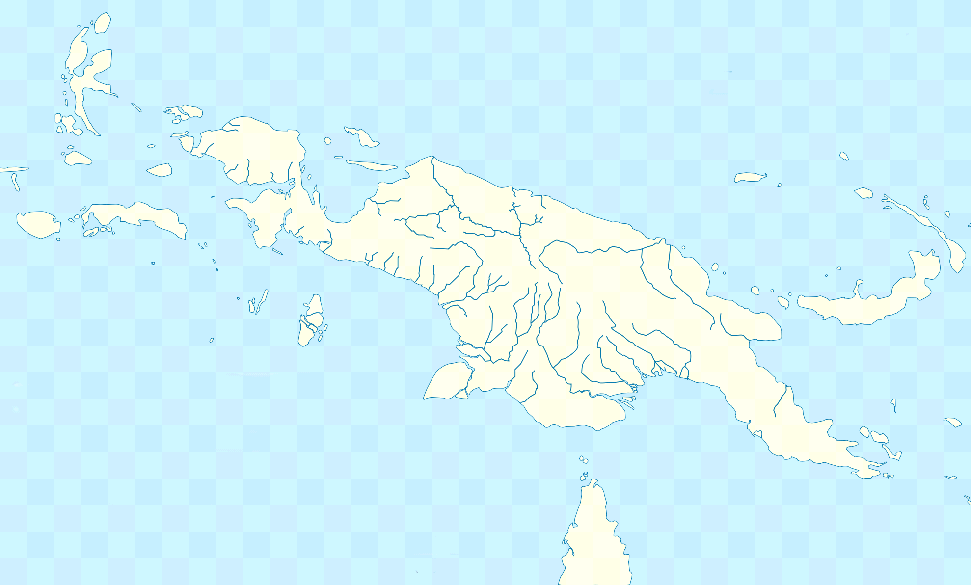
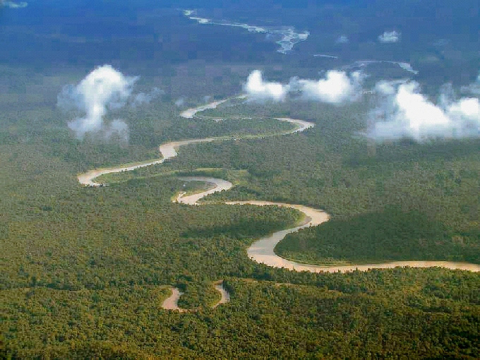
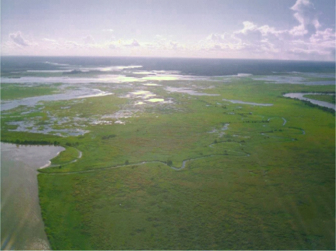
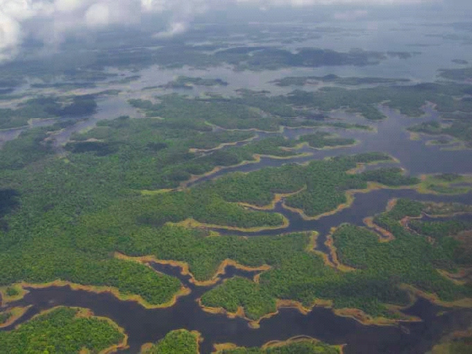
The Digoel (Digul) River rises from the southern slopes of the Sterren Mountains (Maoke Range) near the Papua New Guinea border, and drains southwest across a vast swampy alluvial plain into the Arafura Sea immediately north of Dolak (Frederik Hendrik) Island. The river flows 525 kilometres south and west across a low region of extensive swamps. The Maoke Range is part of the central highlands and is separated in the north from a lower mountain range - the Van Rees Mountains by a valley 322 kilometres long. To the south the Maoke Range drops sharply to a marshy floodplain along the Arafura Sea. The Lorentz, Baliem, and Digoel rivers drain the southern slopes, forming several large deltas along the Arafura coast.
The Fly River system has a catchment area of approximately 76 000 km2. There are three major rivers in the system: the Ok Tedi, which drains the Hindenburg Ranges; the Fly, which drains the southern part of the Victor Emanuel Range; and the Strickland, which drains the Victor Emanuel and Central Ranges. The Purari River originates in the Bismarck Range and flows approximately 470 kilometres to the Gulf of Papua in the south. The Purari has a 33 670 km² catchment area and is the third largest river in Papua New Guinea. Lake Tebera is part of the Purari River system. The Kikori River catchment is closely interconnected with the Purari River catchment to the east and the Omati River catchment to the west, whose freshwater delta regions interconnect during both wet and dry seasons.
As a result of the high rainfall and rugged topography, most rivers in New Guinea have large flow volumes and high sediment loads, and are generally fast-flowing and turbulent. However, water levels in the main rivers fluctuate dramatically through the year, creating a variety of aquatic habitats including swampy and flooded forest, swampy grasslands, oxbows, and small lakes. Mangroves, brackish swamps, freshwater swamps and alluvial plains account for 7.5 percent of the total land area of the country. Lowland freshwater wetlands are a mosaic of open water, herbaceous swamp, swamp savannah, and woodland. Soft, slightly alkaline water chemistries characterise the larger rivers and most lakes. Acidic conditions are found in many small creeks flowing through swamps or intact forest along the coast.
Biodiversity
The Wallace Line is a boundary that separates the zoogeographical regions of Asia and Australasia. West of the line are found organisms related to Asiatic species; to the east, most organisms are related to Australian species. The line is named after Alfred Russel Wallace, who noticed the apparent dividing line during his travels through the East Indies in the 19th century.
West of this line lies the Indo-Malayan region, which includes the Greater Sunda Islands of Java, Borneo and Sumatra on the Sunda shelf; to the east lies the Australasian region. During the Pleistocene period some 10,000 years ago, sea-levels were much lower than at present. The Greater Sunda Islands were connected by dry land to the Asian mainland, while New Guinea and the Aru Islands were joined to Australia. The islands of the Sahul shelf which include Waigeo, Batanta, Salawati and Misool to the west; and Japen to the north in Cenderawasih Bay all had recent intermittent land connections with mainland New Guinea. Wallacea, comprising the Lesser Sunda Islands (Nusa Tenggara), the Moluccas and Sulawesi, has had no recent land connection to either continent.
New Guinea ranks among the top biologically important regions of our planet, boasting as many bird and plant species as nearby mega-diverse Australia in one tenth the land surface. Home to a unique array of plant and animal species including the fabled birds of paradise, birdwing butterflies, tree-kangaroos, and more species of orchid than anywhere else on Earth. The Raja Ampat archipelago off New Guinea’s western tip is now known to support the most diverse coral reefs on Earth.
The richness of New Guinea’s fauna and flora has long attracted the attention of naturalists. Each succeeding collection, producing new species and extending the ranges of forms already known, has but emphasised the fact that there is still much zoological exploration to be done. Not only in defining ranges of known forms and discovering new ones, but also in finding out something about their habits and habitats concerning which, for many of the species, practically nothing is known. New Guinea is today less known than any other habitable area of equal size on the globe.
New Guinea contains very high levels of biodiversity and species endemism. Freshwater endemic species are found throughout New Guinea because almost all lakes are unique ecosystem with endemic species. Unfortunately there is a profound absence of biological information available. The best-known aquatic fauna are the fish; this is a result of the extensive surveys by Gerald Allen and others over the past 30 years.
Most of the aquatic habitats in New Guinea are in pristine condition, but some are under threat from increasing development. Many human activities are increasingly disturbing and, in some cases, destroying freshwater habitats. New Guinea’s forests are some of the most biodiverse in the world, but they are increasingly under threat from commercial logging. Pristine forests and mountains have been denuded by indiscriminate logging and road construction. The reefs, coastal seas, rivers and lakes are being over fished. Introduction of exotic plant diseases and predatory freshwater fish have the added potential of destroying the delicate balance of the ecosystem. In parts of (West) Papua illegal harvesting of wildlife is taking a heavy toll on wild populations.
Fish Fauna
Although the marine fishes of New Guinea are reasonably well documented, the same cannot be said of the freshwater fauna. Nevertheless, what little is known illustrates remarkable species diversity and uniqueness as well as close associations with Australia. Nearly all the families, most genera, and numerous species are shared between these two countries.
Field surveys and published taxonomic works have been sporadic since the first species were discovered in the 1860s. Historically there have been considerable problems associated with fieldwork in the interior. Aside from the dangers of malaria and other diseases, potential collectors were discouraged by the hazards of overland travel across very difficult terrain. Consequently, most early collections were obtained near the coast or along navigable rivers. The most active period of ichthyological exploration occurred between 1903 and 1920 by Dutch naturalists. The majority of these early collections were summarised by Weber in 1913. By 1925, a total of approximately 100 species had been recorded from fresh waters. These indicated a high degree of specialisation and endemism in the freshwater fish fauna.
The freshwater ichthyofauna can be clearly divided into two biogeographical regions. Freshwater bodies to the south of the central highlands have an ichthyofauna closely allied with that of northern Australia, reflecting a former land connection. While several of those species with diadromous habits can be found in both southern and northern rivers, the fish permanently inhabiting freshwater in the north are invariably different species from those in southern water bodies. Apart from the land barrier formed by the central highlands, northern rivers are much younger than southern rivers. Of those fish families common to both northern and southern rivers, species diversity is invariably lower in the north.
Existing knowledge of the fishes of New Guinea have been published in field guides and checklists. Freshwater fishes of New Guinea were reviewed by Allen (1991), who listed 316 species, including some estuarine forms; subsequent collecting and research have taken this count to around 360 of which approximately 46% are endemic, but since vast areas have yet to be sampled, the exact number is unknown. There are several areas that have particular potential as reservoirs of undiscovered species. Of great concern is the observation that this endemicity is matched by the numbers of exotic fish (17%), introduced since the 1970s. The Snakehead (Channa striata) and Climbing Perch (Anabas testudineus) are particularly threatening to the native fish. Threats from introduced invasive species are often underestimated in New Guinea.
Since 1970 about 130 New Guinea freshwater fish species or subspecies have been described or are awaiting description. New species have been found and described at rates as high as any in the history of New Guinea ichthyological exploration. In general, the fish fauna of New Guinea is closely related to that of northern Australia.
As in Australia, the most diverse taxa in New Guinea are also Eleotrididae and Gobiidae, with about 115 species, followed by Melanotaeniidae with about 60 species. About 50 species from southern New Guinea also occur in northern Australia and are restricted to these two areas (Lundberg et al. 2000).
There has been a pronounced renewal of interest in the freshwater fauna during the past 30 years, in part due to the development of an efficient air transport network, as well as road construction in previously inaccessible districts. The number of fish species found in New Guinea seems to increase each time a qualified researcher enters a new area. Gerald Allen has added at least 80 new fish species to the scientific literature. This includes about 40 species of rainbowfishes (including one new genus), 9 species of blueeyes, 14 species of gudgeons, 9 species of gobies, plus various species in other families.
Most recent research has involved Papua New Guinea, the island’s eastern half. Comprehensive surveys have been conducted for the Fly, Purari, Laloki, Kikori, Sepik, Ramu, and Gogol rivers, as well as many other regions. As a result of these investigations there now exists a fairly comprehensive knowledge of the fishes inhabiting the eastern half of the island. Unfortunately, the western half, the Indonesian province of West Papua, remains poorly studied. Our knowledge of the fishes of this vast area is still largely based on the now out-dated work of the early Dutch explorers. The Timika region and sections of the Mamberamo basin have been sampled, but most regions remain unsurveyed.
Two closely related families are unique to the Australia − New Guinea region: the Melanotaeniidae (rainbowfishes) and Pseudomugilidae (blue-eyes). Because of its mountainous terrain and consequent abundance of isolated freshwater drainage systems, New Guinea represents a particularly rich area for rainbowfishes. More than 80% of the known species of rainbowfishes are found in New Guinea, and no doubt more will be discovered as a result of future systematic surveys.
In West Papua, several scientific expeditions have been undertaken since 2007 by the Institut de Recherche pour le Développement (IRD), the Akademi Perikanan Sorong (APSOR) and the Badan Riset Kelautan dan Perikanan (BRKP) in Depok. Many rainbowfishes have been collected during these surveys and a number of them still await formally description.
Many rainbowfishes appear to be restricted to an isolated lake or small part of a river system, making them very vulnerable to environmental disturbances like logging or dam construction. Lake Sentani and Lake Kutubu are two areas that have unique fish faunas that are extremely vulnerable (Allen 1991).