

Pelangia mbutaensis
Lake Mbuta Rainbowfish
Species Summary
The Pelangia genus is the sister group of Glossolepis, judging from external appearance and osteological features, particularly with regards to dentition, and morphology of the premaxillary, pelvic girdle, and pectoral fin (Allen 1980). However, it differs from Glossolepis with regards to several important features including a lack of teeth on the vomer and palatines, a larger mouth (jaws extend to below front of eye, but fails to reach eye in Glossolepis), a larger eye (horizontal diameter exceeds caudal peduncle depth; equal to or less than depth in Glossolepis), reduced crenulations on the scale margins, and fewer anal rays (14–18, usually 16 compared with 18–22 in Glossolepis). There are also differences in the positions of the fins. The anal fin origin is closer to the caudal fin base than to the snout tip, which is the opposite situation compared to Glossolepis. Moreover, the origin of the first dorsal fin is well ahead of the anal fin origin, but in Glossolepis it is either even with the anal fin origin or behind it. Finally, the second dorsal fin origin is approximately level with the third soft anal ray in Pelangia, but in Glossolepis it is usually level with the middle rays.
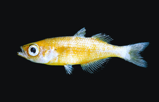
Pelangia mbutaensis was described on the basis of 52 specimens collected in 1997 in the Mbuta Basin near Etna Bay, West Papua. Preserved specimen have a yellowish-tan body colour grading to silvery-white on the lower half of sides. Larger males have scattered yellow flecks along the middle of the side. Fins are mainly translucent except for dusky grey pigmentation on the first dorsal fin.
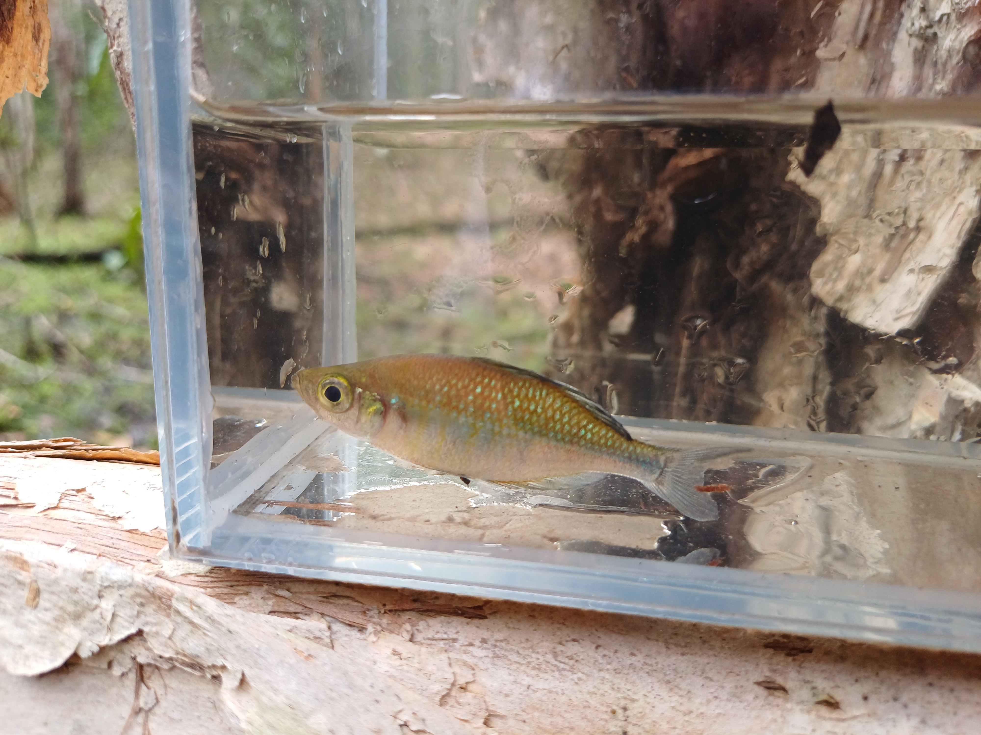
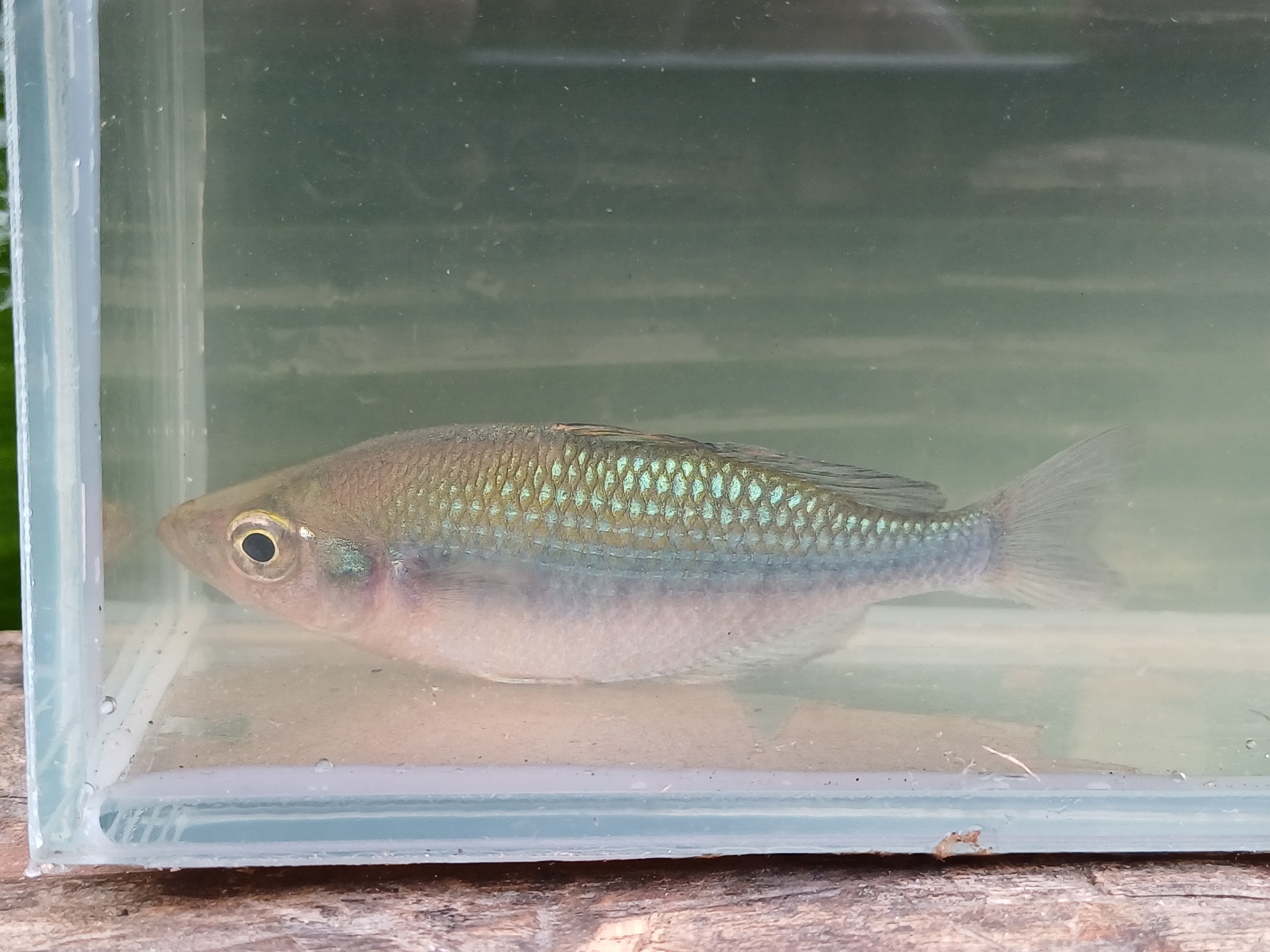
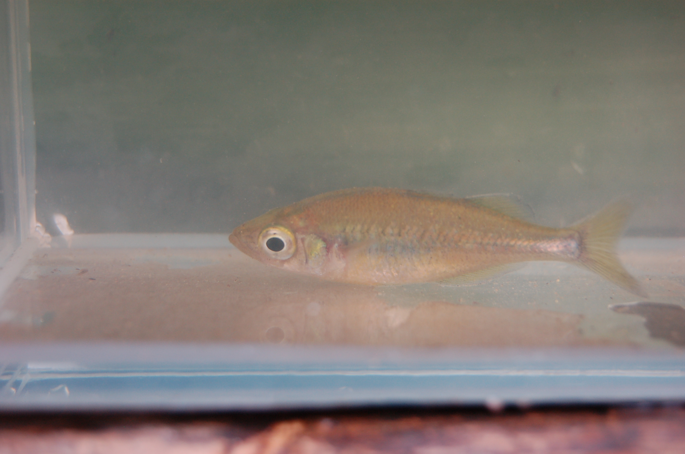
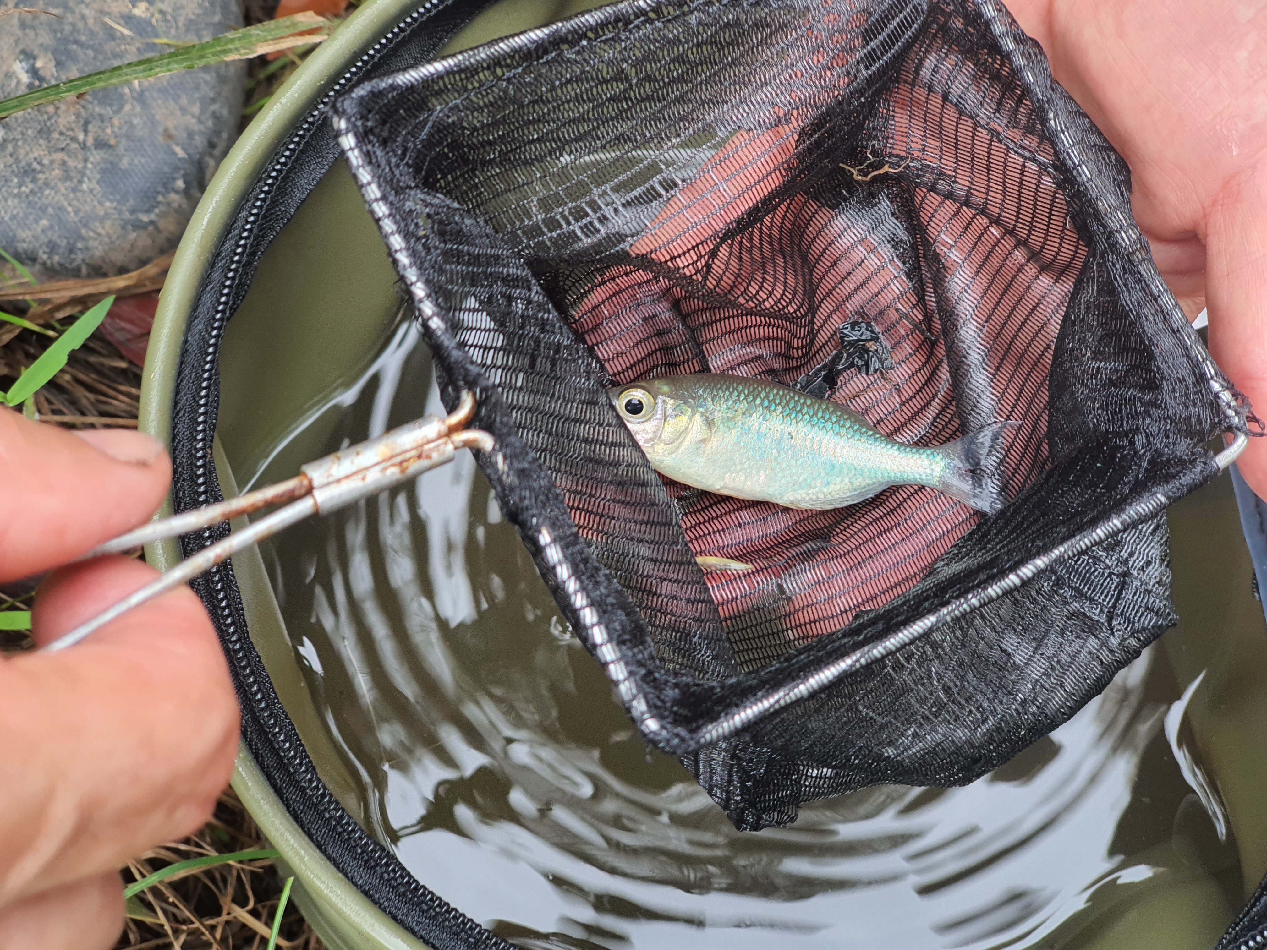
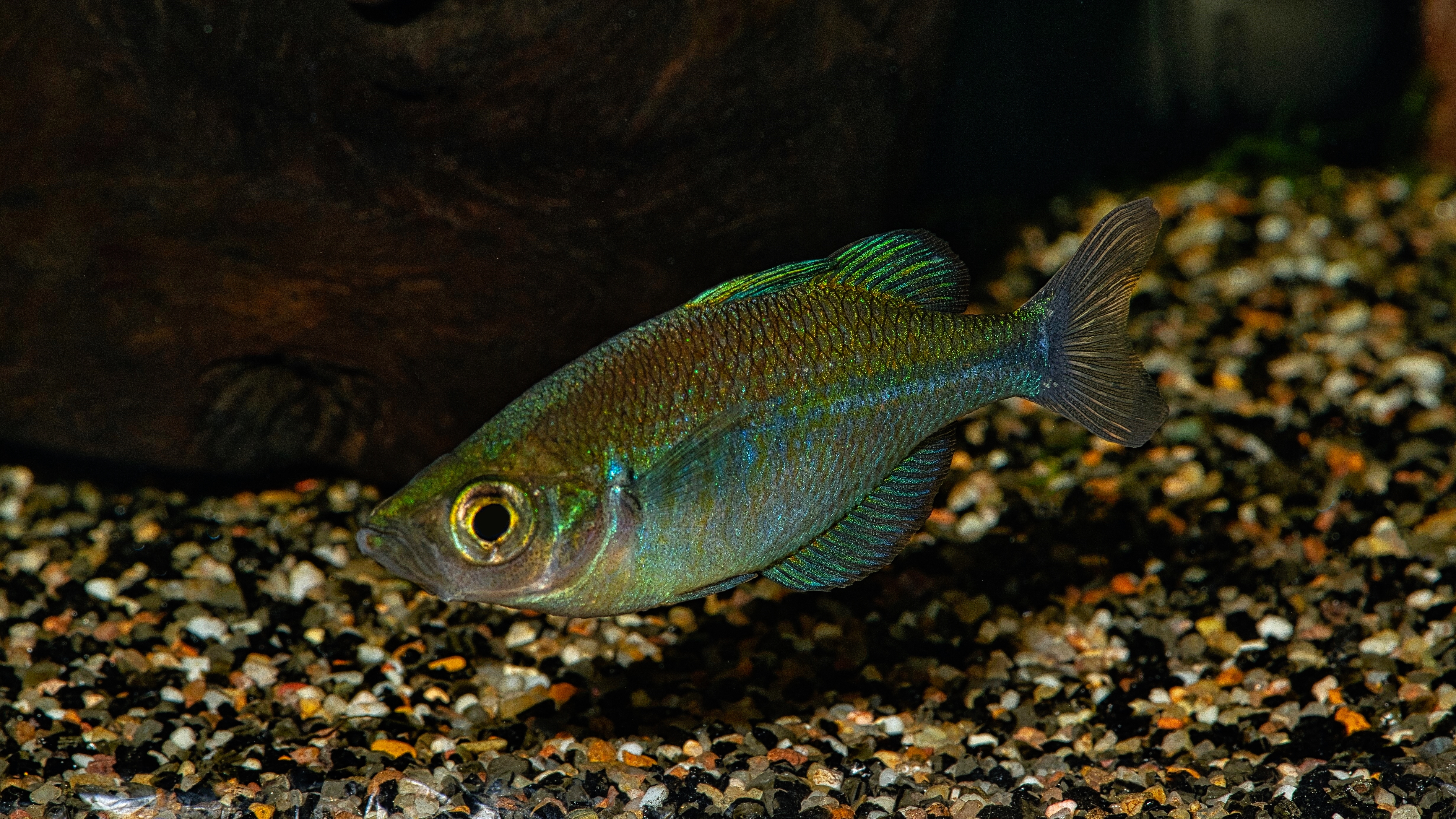
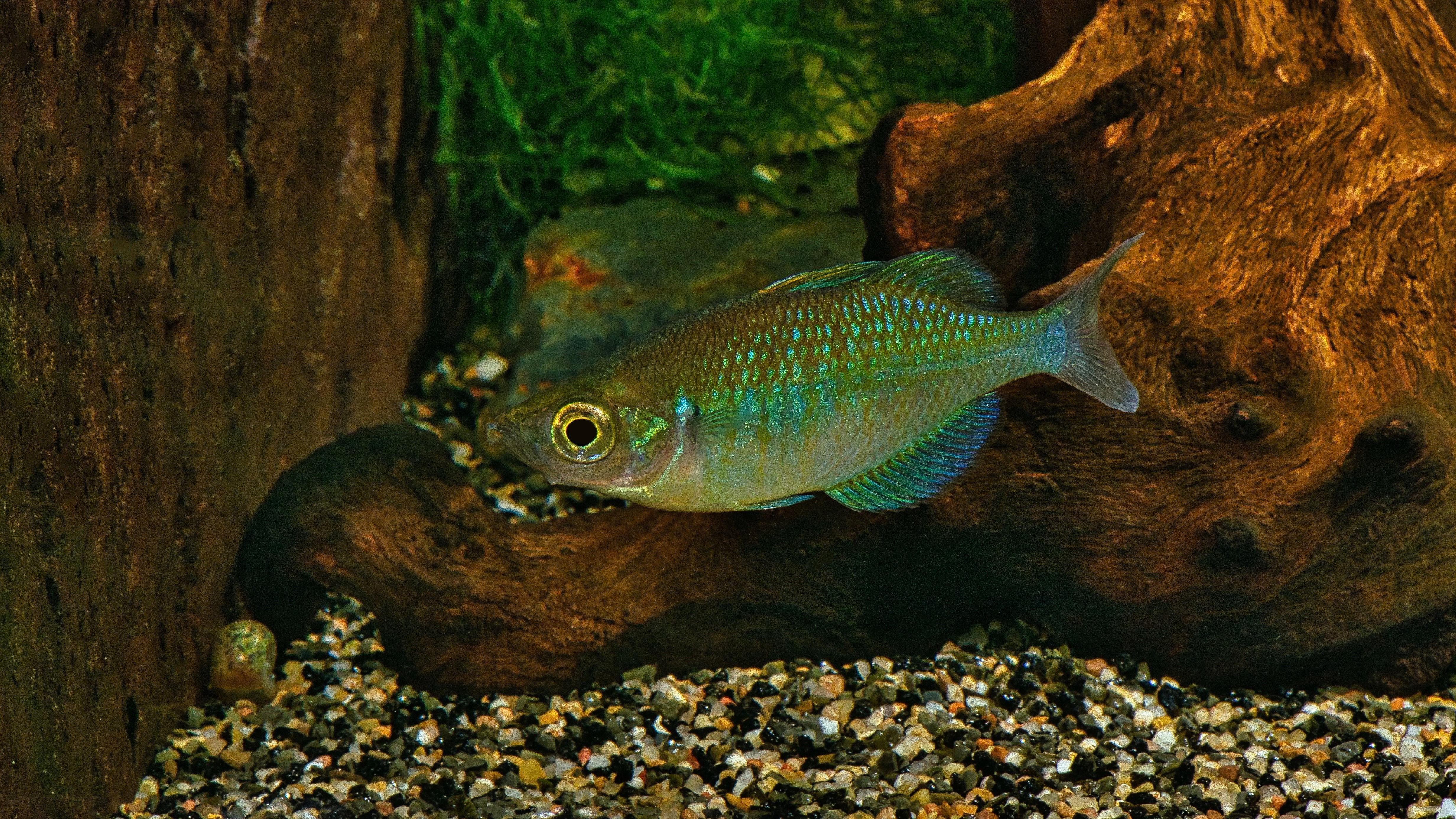
In 2023, live specimen were collected by Graf, Heemskerk, Mailliet and Ohee in Kali Swykay. Kali Swykay connects a swampy basin located just north of Lak Mbuta with the lake itself. As was to be expected, the live colours were much more vibrant than those of the preserved specimen (see pictures of freshly caught specimen, as well as of an aquarium specimen). The back of the males is coppery orange on the anterior part, fading into a shiny green and blue posterior half. The belly is whitish-grey to yellow. There is no distinctive lateral line, however the coloration is more intensive along the middle of the body. The unpaired fins are semi-transparent with a bluish tinge and dark fin rays, and a vivid blue-green spot is present on the operculum. Females are uniformly brown to yellowish, with transparent fins and no distinctive markings, except for a yellow-golden spot on the operculum.
Males have a slightly longer first dorsal fin, which slightly overlaps the second dorsal fin origin when depressed. By contrast, the depressed first dorsal fin of females fails to reach the dorsal fin origin or barely reaches it. In addition, males generally have a deeper body than females. The average body depth as percentage of the SL for eight mature males, 45.2–55.5 mm SL (average = 49.3 mm SL) was 31.3 compared with an average of 28.0 for six females, 43.0–51.4 mm SL (average = 47.9 mm SL).
Etymology
The genus name Pelangia comes from pelangi, the Indonesian word for rainbow, referring to rainbowfishes. The species name mbutaensis is a suffix denoting place, referring to the Lake Mbuta Basin, Irian Jaya, Indonesia, where it appears to be endemic.
Etymology compiled from C. Scharpf (2021), “Fishes of Sahul: An Etymological Survey (Part 4), the Rainbowfishes”, Fishes of Sahul 35(1): 1706–1714, and etyfish.org.
Distribution & Habitat
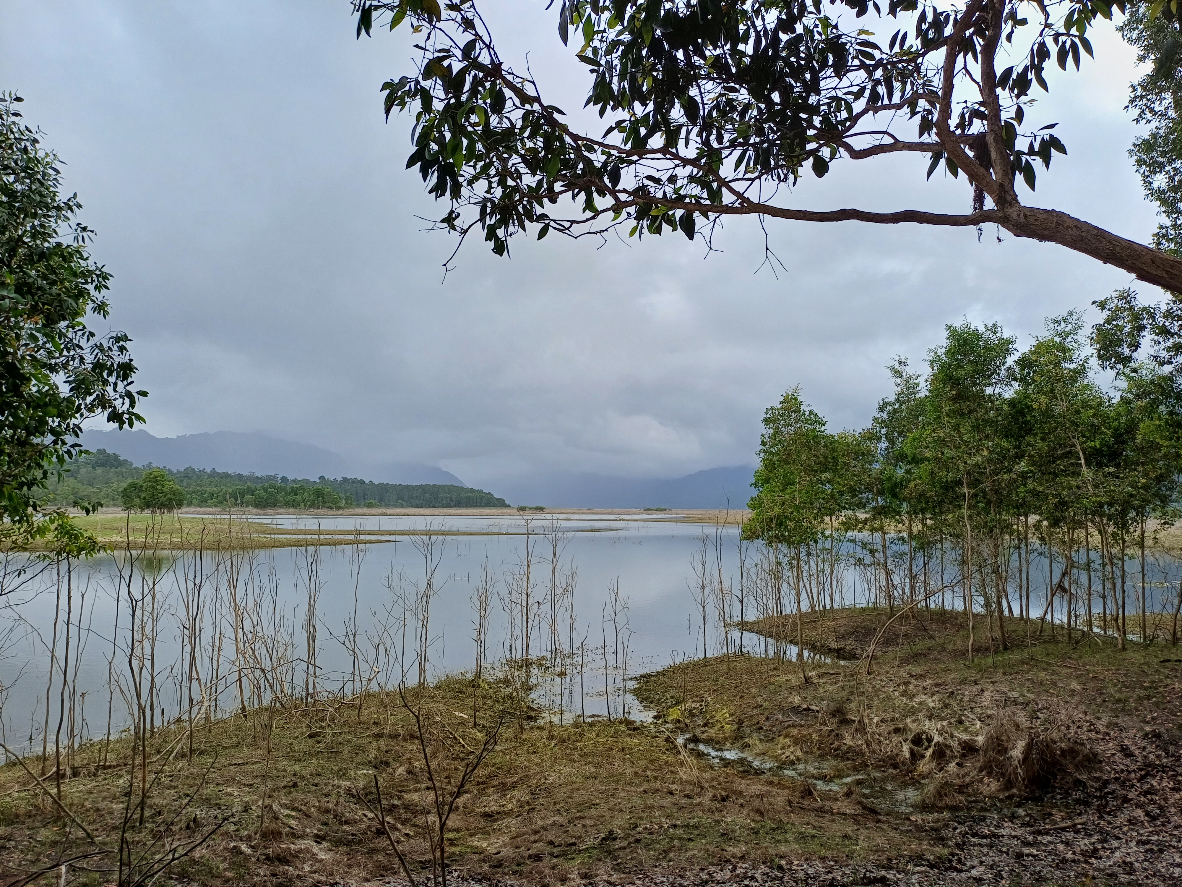
Allen describes Lake Mbuta as a “roughly circular basin” located approximately 8km inland from Etna Bay, and provides the coordinates for the type location as follows: 3°58′01.0″S, 134°57′04.0″E. However, these coordinates correspond to a location at the extreme eastern end of Etna Bay, roughly 40 km away from Lake Mbuta. When researching available information about P. mbutaensis in preparation of the 2023 collecting trip, Mailliet realised that there had probably been transcription errors (both in the format of the coordinates as well as an inversion of single digits) in the original description. When entering the coordinates as Decimal Degrees (DD) instead of Degrees Minutes Seconds (DMS), ie: -3.58010, 134.57040, the resulting location is a place ca. 40km straight north of Lake Mbuta. However, when inverting the digits for decimal minutes to: -3.85010, 134.57040, the given location corresponds to a swampy basin dotted with numerous lakes and ponds (as described by Allen), just north of Lake Mbuta proper, and separated from it by a mountain range with up to 400m of elevation. Incidentally, the same transcription errors seem to have happened in the original description of Mogurnda mbuta. This swampy basin does not appear to have a name, as even the locals just referred to it as “the swamp”. On available maps and satellite images, this basin appeared to be connected to Lake Mbuta via streams and swampy areas.
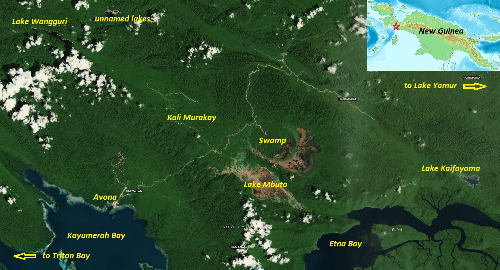
Lake Mbuta as well as the basin just north of it have been connected to the coast by a logging road for several years now. This road connects the coastal village of Avona to several inland valleys, and is projected to eventually reach Lake Yamur and the northern coast near Nabire. Both Lake Mbuta and the swampy basin north of it are subject to dramatic water level fluctuations, and have no visible outlet. However, Indonesian-French expeditions (led by Pouyaud et al.) were able to confirm that the lake has two subterranean outlets, that re-emerge south of the mountain ridge near Avona. A recent paper (Kalacska et al. 2026) documents these water level fluctuations, which were also visible during the visit in August 2023, when the water level was relatively low and large portions of the bottom of the lake were exposed.
From available maps and satellite imagery, it appears that Lake Mbuta and the northern basin are at least temporarily connected during times of high water, which was confirmed to the collecting party by the local villagers. They effectively form a single body of water and are therefore very likely to share the same species, which was confirmed by the findings. The northern basin and Lake Mbuta are apparently mainly connected via a larger stream that local guides called Kali Swykay, which drains the swamp area into Lake Mbuta. Kali Murakay feeds into the western end of the lake, after flowing through a north west-south east oriented valley, at the end of which Lake Mbuta and the northern swamp are located. There are at least two major waterfalls separating the lake from the upper reaches of Kali Murakay.
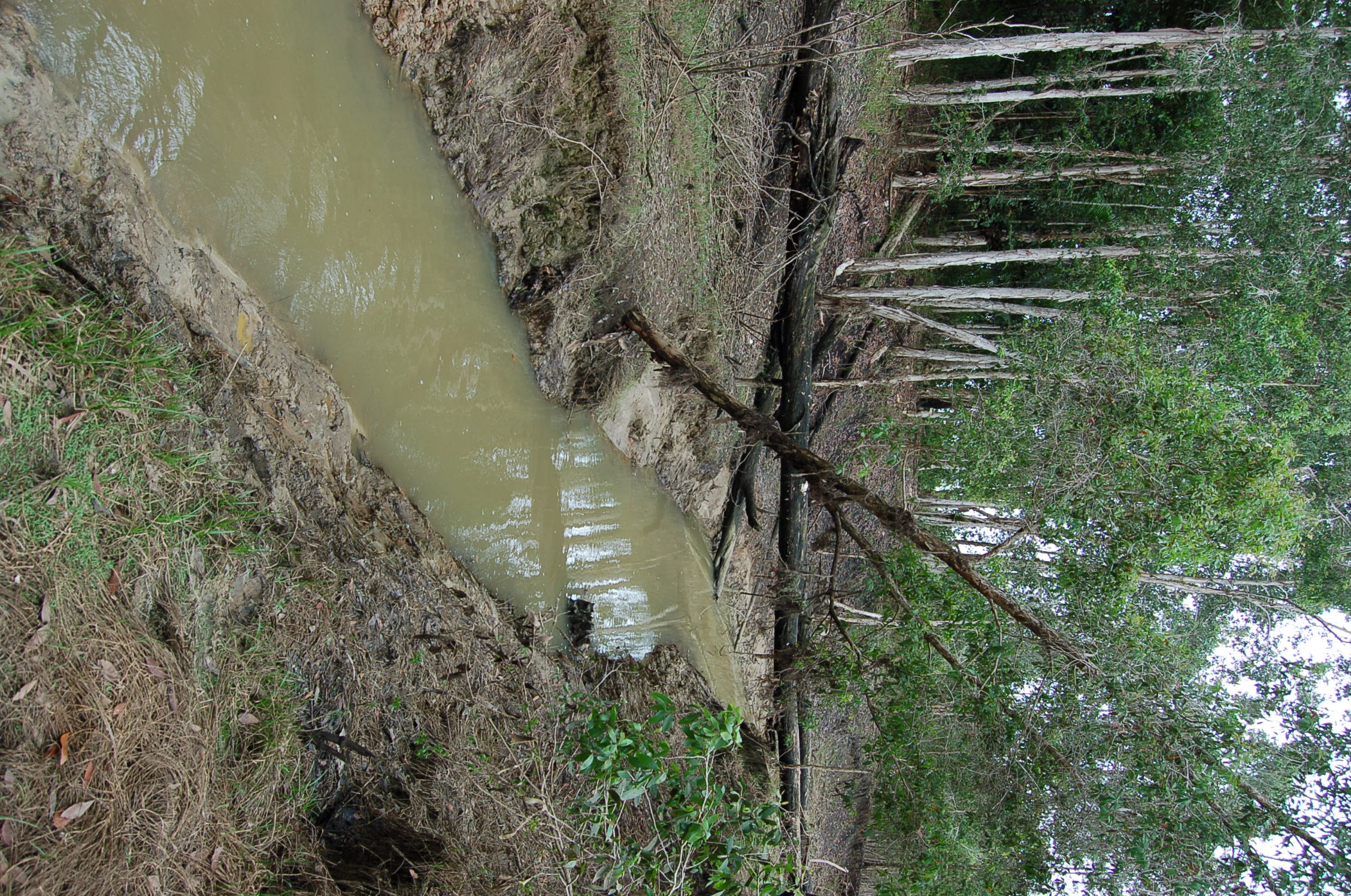
Pelangia mbutaensis were collected in a small creek approximately 2–3 metres in width, with depths to about 2 metres. The collection was made over a 50 metre long section immediately above its confluence with a small turbid river. The water was very clear, but darkly stained (tea-coloured), with relatively fast flow through forest that formed a nearly closed canopy. The bottom consisted mainly of mud with occasional rocks and log debris with sparse aquatic vegetation. A water temperature of 25.8°C and pH of 6.4 were recorded. Other rainbowfish inhabitants included Melanotaenia lacunosa. Pelangia mbutaensis was relatively common, but outnumbered by M. lacunosa by a 3:1 ratio.
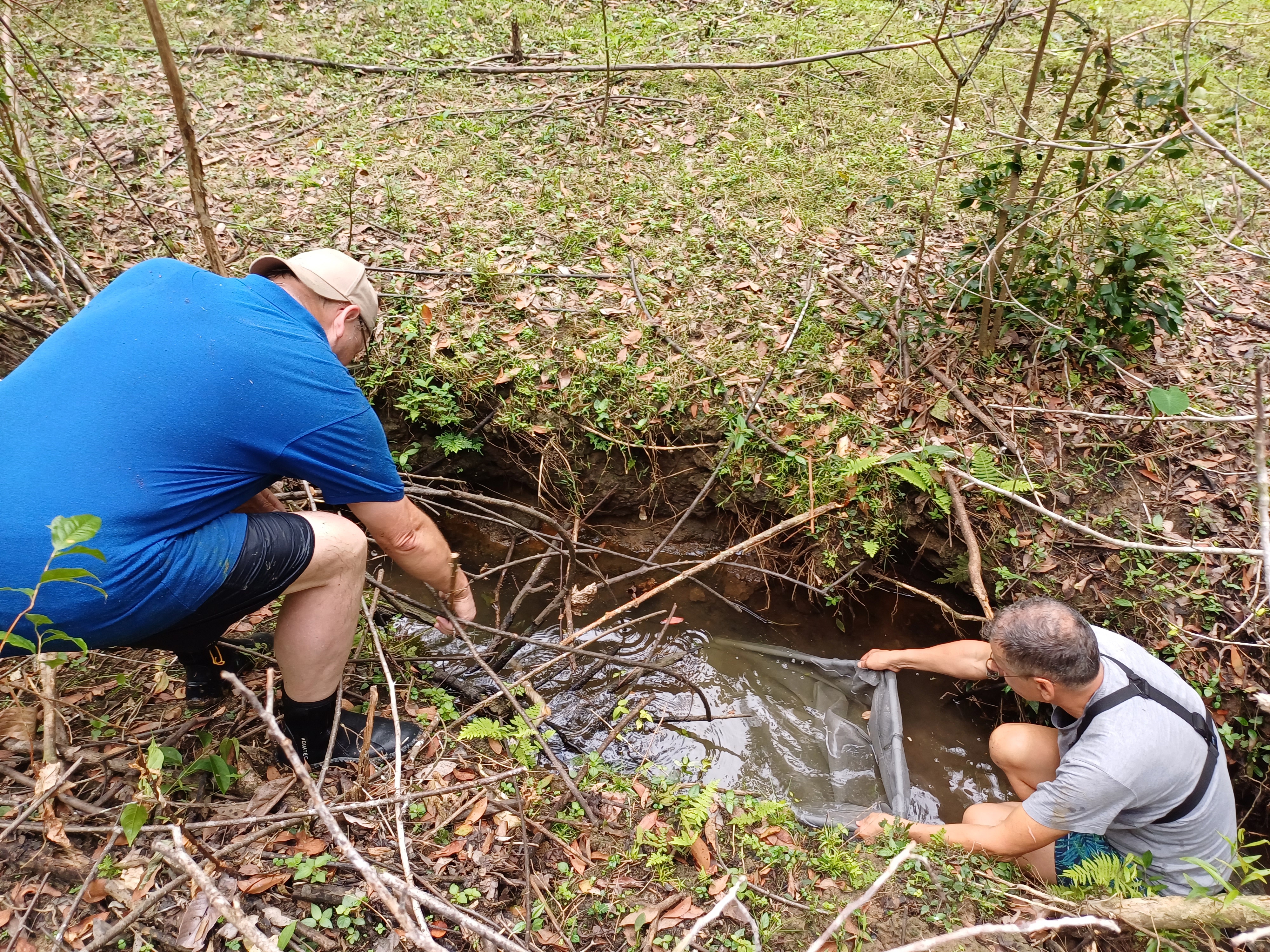
Further specimens were collected in 2023 in a small and shallow stream feeding into Lake Mbuta as well as in Kali Swykay, a larger stream draining the swampy area north of Lake Mbuta and feeding into the lake proper. It was not possible to fish in the lake itself due to the presence of very large crocodiles in the lake.
The water conditions in Kali Swykay were as follows: pH 8; hardness GH >16, KH 10; conductivity 323 µS; temperature 26°C. The bottom of Kali Swykay consisted of clay and mud, the water was clear and slightly tannin-stained. No water plants were observed. Other fish caught at that site were Craterocephalus sp. (“small gold”), Craterocephalus sp. (“large blue-grey”), Melanotaenia lacunosa, and Mogurnda mbuta.
Remarks
The export of live specimen to Europe failed, as P. mbutaensis proved very sensitive to stress and transport. Only two males survived the trip back, so that this species is currently not available in the hobby.
Pelangia mbutaensis are currently classified as critically endangered by the IUCN, based on an assessment from 2020. It is true that the accessibility by road to the lake is a potential threat to its inhabitants. However, this area still remains very remote and devoid of any permanent settlements so far, and the lake itself as well as its tributaries are quite far removed from the road. Unlike in many other places in New Guinea, there does not seem to be any introduced fish species in the lake, which is likely to remain the case as long as there are no permanent settlements there, since especially migrants from other parts of Indonesia have often introduced Oreochromis/Tilapia, Channa spp. and other species in many locations where they have settled. The fluctuations in water levels seem to be a constant feature of the lake and the adjacent basin, which are located in a karstic region.
All species that were collected in 2023 were seemingly able to survive in very small feeder streams that probably act as a refuge during times of low water levels, and allow for repopulation in times of flooding. The same conditions appear to prevail in Lake Kaifayama, which seems to dry out periodically and is “full of fish” in times of flooding, according to the locals. Thanks to it remoteness and considering the geographical area covered by Lake Mbuta and the northern basin, as well as the large number of streams, ponds etc. all around those water bodies, it seems that the future of Pelangia mbutaensis and the other species of the area is safe – as long as no major disaster occurs.
References
- Allen G.R. (1998) A new genus and species of Rainbowfish (Melanotaeniidae) from fresh waters of Irian Jaya, Indonesia. Revue Française d'Aquariologie 25(1-2): 11-16.